Geovisualisation 3D pour la concertation des PLU
Sélection de publications
- Brasebin, M., Christophe, S., Jacquinod, F., Vinesse, A. and Mahon, H. (2016) 3D geovisualization & stylization to manage comprehensive and participative local urban plans, ISPRS Ann. Photogramm. Remote Sens. Spatial Inf. Sci., IV-2-W1, 83-91, doi:10.5194/isprs-annals-IV-2-W1-83-2016.
- Brasebin, M., Buard, E., Christophe, S. and Pelloie, F. (2015) A knowledge base to classify and mix 3D rendering styles, 27th International Cartographic Conference (ICC'15), Rio de Janeiro, Brazil
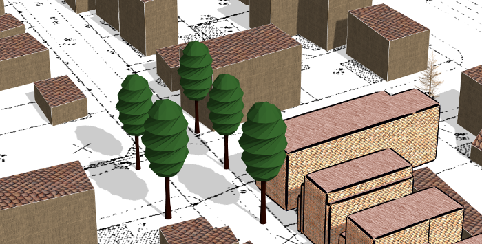
Représentation de résultats de simulation avec des arêtes Sketchy (Brasebin, 2016)
Représentation d'autres phénomènes en 3D
Sélection de publications
- Buard, E. and M. Brasebin (2011) Visual exploration of large animal trajectories, 25th International Cartographic Conference (ICC'11).
- Brasebin, M., B. Bucher and C. Hoarau (2010) Enriching a 3D world with synthetic and visible information about the distribution of points of interest, 5th 3D GeoInfo Conference (3DGeo'10).
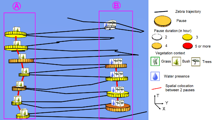
Visualisation des allers-retours d'éléphants entre deux lieux (Buard et al, 2011).